Garmin Montana 700i

749.00 €
3 installments of 249.67 €
 free of charge

The i-Run team says

Your Guide to Extreme Adventures


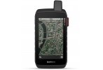
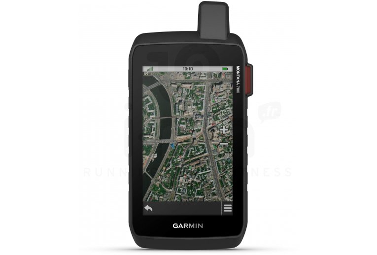
Discover the features of the Garmin Montana 700i Portable GPS and fully enjoy your outdoor activities. Whether you?re on a bike, on foot, or on a quad, it follows your most extreme adventures without fail.


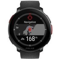
During your hikes in difficult terrains, GPS satellite networks like GLONASS and GALILEO offer you a precise and reliable position. The preloaded TopoActive Europe map provides essential information for orientation such as coasts, peaks, and watercourses.


Analyze your environment better with the included sensors. The altimeter handles altitude data while the barometer indicates atmospheric pressure. A 3-axis electronic compass completes the set.


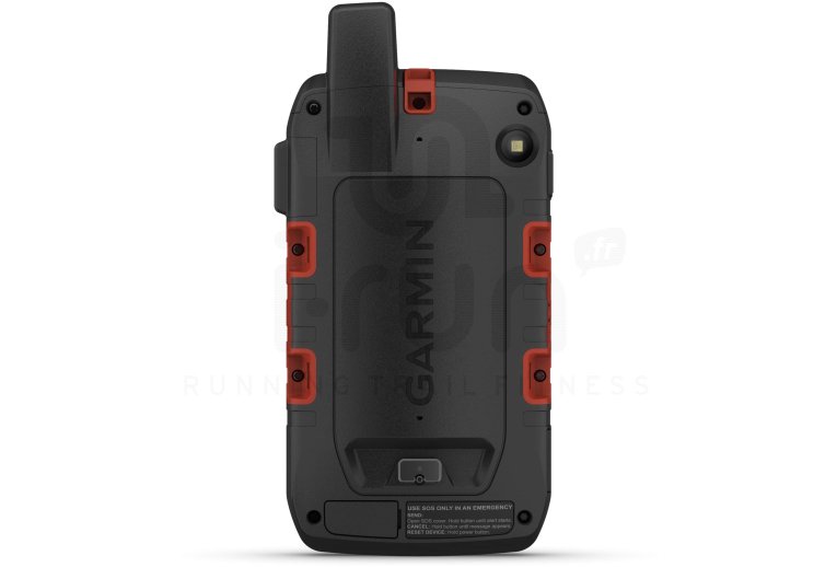
Download BirdsEye satellite imagery directly to your device using the WiFi connection and set your waypoints. Pairing gives you access to the Garmin Explore app, allowing you to easily manage your routes.


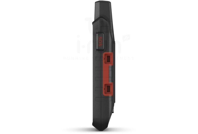
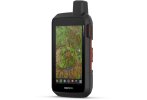
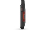
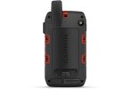
Certified by the MIL-STD 810 standard, this model boasts exceptional resistance to extreme temperatures, shocks, water, and vibrations. It is therefore equally recommended for foot and vehicle use.


Navigation on the touchscreen is simplified by its 5-inch size and anti-glare treatment. Its autonomy extends up to 18 hours in GPS mode but can be extended up to 330 hours in Expedition mode.


Designed for your canine companions, the dog tracking feature allows you to pair with a compatible device to better monitor your travel partner.


Key Points of the Garmin Montana 700i Portable GPS

  • GPS designed for outdoor activities with or without a vehicle
  • City Navigator Maps: road navigation
  • Iridium satellite network connectivity: requires an active communication time subscription to use Iridium satellite communication functions
  • Two-way messaging: send and respond to your messages via the Iridium satellite network (subscription required)
  • Interactive SOS
  • Tracking: track your position and share it (subscription required)
  • Inreach Weather: weather forecast service
  • GPS, GALILEO, and GLONASS satellites: location and guidance even in isolated and difficult environments (dense forests, urban canyons...)
  • Compatible with multiple GNSS
  • ABC sensors: altimeter, barometer, and 3-axis electronic compass
  • Bluetooth, WiFi, and ANT+
  • Dynamic Weather
  • Dog tracking: connection with a compatible Astro or Alpha portable device
  • Smart Notifications
  • Compatible with the Garmin Explore app and website
  • Information on terrain difficulty, terrain description, and tips for progress
  • TopoActive Europe: preloaded mapping
  • Location of points of interest, natural sites, borders, and watercourses
  • 16 GB internal memory: add new maps
  • Slot for an optional microSD card: memory
  • 5-inch anti-glare color touchscreen: simplified reading and use
  • MIL-STD 810 standard: resists extreme temperatures, shocks, water, and vibrations
  • Waterproof: IPX7
  • Battery life: 18 hours in GPS mode and up to 330 hours in Expedition mode
  • Dimensions: 9.19 x 18.30 x 3.27 cm
  • Color: black
Read more Read Less

Technical description

Physical Characteristics:

  • Physical Dimensions: 9.19 x 18.30 x 3.27 cm
  • Touchscreen
  • Display Size (width x height): 6.48 ? 10.80 cm; 12.70 cm diagonal (5 in)
  • Screen Resolution (width x height): 480 x 800 pixels
  • Display Type: Transflective color WVGA, dual orientation
  • Weight: 410 g with included lithium-ion battery
  • Battery: Internal, rechargeable lithium-ion (included)
  • Battery Life: Up to 18 hours in GPS mode and up to 330 hours in Expedition mode
  • Water Rating: IPX7
  • High-sensitivity receiver
  • MIL-STD 810: Resistant to extreme temperatures, shocks, water, and vibration
  • Interface: High-speed mini USB and NMEA 0183 compatible
  • Memory: 16 GB


Sensors:

  • GPS
  • GLONASS
  • GALILEO
  • Barometric Altimeter
  • Compass
  • GPS Compass (while moving)


Main Features:

  • City Navigator Maps: Road navigation
  • Iridium Satellite Network Connectivity: Requires an active subscription for satellite communication features
  • Two-way Messaging: Send and reply to messages via the Iridium satellite network (subscription required)
  • Interactive SOS
  • Tracking: Track and share your position (subscription required)
  • Inreach Weather: Weather forecast service
  • Preloaded TopoActive Europe maps (routable on roads and trails)
  • Ability to add maps
  • Base map
  • Automatic route calculation (turn-by-turn routing function)
  • Map segments: 15,000
  • BirdsEye directly on device
  • Detailed hydrographic features (coastlines, lake and river shores, swamps, and seasonal and perennial streams)
  • Points of interest with search function (parks, campsites, viewpoints, and picnic areas)
  • Displays national, federal, local parks, forests, and nature reserves
  • Storage and power capacity: MicroSD card up to 32 GB (not included)
  • Supports GPX files for geocaching
  • Base map
  • Waypoints: 10,000
  • Tracks: 250
  • Track log: 20,000 points, 250 saved tracks, and 300 saved fit activities
  • Routes: 250, 250 points per route; 50 automatic route calculation points
  • Rinex connection
  • Point-to-point navigation
  • Compatible with Basecamp
  • Area calculation
  • Xero position
  • Hunting and fishing calendar
  • Sun and moon information
  • Geocache mode
  • Dynamic weather
  • Custom MAPS compatible: 500 custom map zones
  • JPEG viewer
  • LED beacon
  • InReach remote widget
  • Dog tracking when paired with a compatible dog tracking system
  • Smart Notifications on handheld device
  • VIRB remote control
  • Connect IQ (watch faces, data fields, downloadable widgets, and applications)
  • Compatible with Garmin Connect Mobile
  • Compatible with Garmin Explore for waypoints, tracks, routes, and activities
  • Compatible with Garmin Explore website
  • Wireless connectivity: Wi-Fi, Bluetooth, and ANT+
Read more Read Less
No review for this product.
Garmin Montana 700i
Garmin Montana 700i
749.00 €
(3x free of charge: 249.67 €)
I-RUN Running Trail Fitness